|
After leaving the Lakota Museum, I stopped at the impressive Lewis
and Clark Information Center, just off I-90 in Chamberlain. Then
I headed north on SD HWY 50. At Ft. Thompson I picked up SD HWY
34 which turns west at Mac's Corner and meets the Missouri River
near the Fort George boat ramp.. Lake Case, created by the Big Bend
Dam, has inundated all of the L&C sites along here. I decided
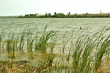
to look for a more natural Missouri south of Pierre. These photos
show the marshes and islands typical of the Corps' experience. Top
left, looking south down the river. Left, looking north toward Pierre
and looking straight across, above.
|